
Caringin topographic map
Interactive map
Click on the map to display elevation.
About this map
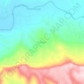
Name: Caringin topographic map, elevation, terrain.
Location: Caringin, West Java, Indonesia (-7.29304 107.04532 -7.25304 107.08532)
Average elevation: 948 ft
Minimum elevation: 456 ft
Maximum elevation: 1,870 ft
Other topographic maps
Click on a map to view its topography, its elevation and its terrain.