
Beitostolen topographic map
Interactive map
Click on the map to display elevation.
About this map
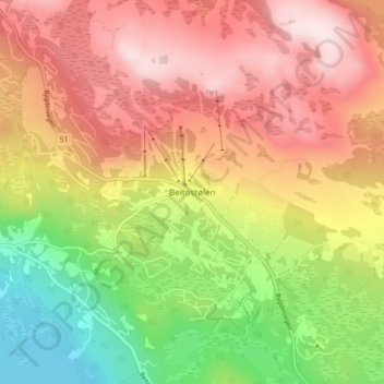
Name: Beitostolen topographic map, elevation, terrain.
Location: Beitostolen, Øystre Slidre, Innlandet, 2953, Norwegen (61.22987 8.88642 61.26987 8.92642)
Average elevation: 3,028 ft
Minimum elevation: 2,215 ft
Maximum elevation: 3,714 ft