
Manchay topographic map
Interactive map
Click on the map to display elevation.
About this map
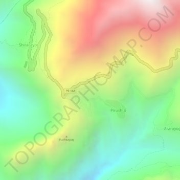
Name: Manchay topographic map, elevation, terrain.
Location: Manchay, PE-14A, Huacaybamba, Huánuco, Perú (-9.06144 -76.88144 -9.06134 -76.88134)
Average elevation: 12,201 ft
Minimum elevation: 10,495 ft
Maximum elevation: 14,291 ft
Other topographic maps
Click on a map to view its topography, its elevation and its terrain.
Provincia de Huacaybamba
Perú > Huánuco > Huacaybamba
Provincia de Huacaybamba, Huacaybamba, Huánuco, Perú
Average elevation: 12,365 ft