Geolocate

Panacan I topographic map

Click on the map to display elevation.

About this map

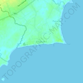
Name: Panacan I topographic map, elevation, terrain.

Location: Panacan I, Narra, Palawan, Mimaropa, 5303, Philippines (9.22640 118.38904 9.26640 118.42904)

Average elevation: 10 ft

Minimum elevation: -3 ft

Maximum elevation: 49 ft

Gear up for your next adventure:

🌡️Portable Weather Meter - Track weather conditions on the trail
🧯Emergency Survival Kit - All‑in‑one survival essentials for the backcountry
Backpacking Tent - Lightweight and durable tent for multi‑day hikes
🛰️Handheld GPS Units - Professional satellite navigators for precise backcountry mapping
Camping Coffee Makers - Enjoy premium coffee at the summit or campsite

As an Amazon Associate, this site earns from qualifying purchases at no extra cost to you.