
Via Domitia topographic map
Interactive map
Click on the map to display elevation.
About this map
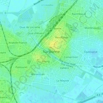
Name: Via Domitia topographic map, elevation, terrain.
Average elevation: 30 ft
Minimum elevation: 10 ft
Maximum elevation: 72 ft
Other topographic maps
Click on a map to view its topography, its elevation and its terrain.
Au Pied de Cap de Pla
France > Occitanie > Narbonne > Au Pied de Cap de Pla
Au Pied de Cap de Pla, Narbonne, Aude, Occitanie, France métropolitaine, 11100, France
Average elevation: 112 ft
Grand Quatourze
France > Occitanie > Narbonne > Grand Quatourze
Grand Quatourze, Narbonne, Aude, Occitanie, France métropolitaine, 11100, France
Average elevation: 39 ft