
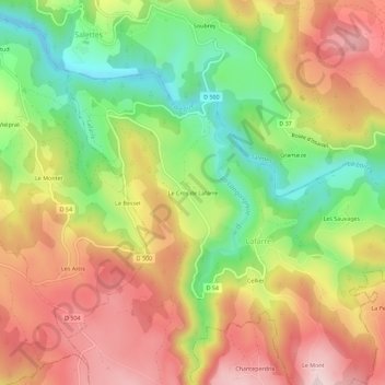
Le Cros de Lafarre topographic map
Interactive map
Click on the map to display elevation.
About this map
Name: Le Cros de Lafarre topographic map, elevation, terrain.
Average elevation: 3,248 ft
Minimum elevation: 2,661 ft
Maximum elevation: 3,809 ft
Other topographic maps
Click on a map to view its topography, its elevation and its terrain.
Cellier
France > Auvergne-Rhône-Alpes > Haute-Loire > Lafarre
Cellier, Lafarre, Le Puy-en-Velay, Haute-Loire, Auvergne-Rhône-Alpes, France métropolitaine, 43490, France
Average elevation: 3,376 ft