
约巴乡 topographic map
Interactive map
Click on the map to display elevation.
About this map
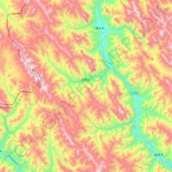
Name: 约巴乡 topographic map, elevation, terrain.
Location: 约巴乡, 卡若区, 昌都市, 西藏自治区, 中国 (31.53228 96.76057 31.89964 97.11392)
Average elevation: 13,855 ft
Minimum elevation: 11,083 ft
Maximum elevation: 16,791 ft
约巴乡(藏語:ཡོར་པ་,威利转写:yor pa)是中国西藏自治区昌都市卡若区下辖的一个乡,位于区境北部,海拔3500米左右,总面积486.81平方千米,2000年人口3155人。传说创建强巴林寺的宗喀巴弟子向生·西绕绒布是约巴人。约巴乡是一个以牧为主的半农半牧乡,主要农牧产品有青稞、小麦、油菜、牦牛、黄羊、山羊、绵羊等。
Other topographic maps
Click on a map to view its topography, its elevation and its terrain.