Geolocate

Álora topographic map

Click on the map to display elevation.

About this map
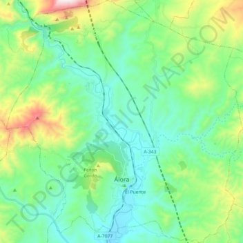
Name: Álora topographic map, elevation, terrain.

Location: Álora, Valle del Guadalhorce, Malaga, Andalusia, Spain (36.78651 -4.79045 36.92789 -4.61822)

Average elevation: 1,122 ft

Minimum elevation: 243 ft

Maximum elevation: 3,835 ft

Other topographic maps

Click on a map to view its topography, its elevation and its terrain.

Zalea

Spain > Andalusia > Valle del Guadalhorce > Pizarra

Average elevation: 456 ft

Gear up for your next adventure:

🌐World Map Poster - Decorative world maps with topographic info
🦺Reflective Outdoor Gear - Safety gear for low‑light conditions
😴Insulated Sleeping Pads - Compact and warm pads for high-elevation camping
👟Men's Trail Runners - Lightweight footwear for fast-paced exploration and light hiking
🚪Portable Camp Chair - Foldable chair for comfort at camp

As an Amazon Associate, this site earns from qualifying purchases at no extra cost to you.