Geolocate

Lukasi topographic map

Interactive map

Click on the map to display elevation.

About this map

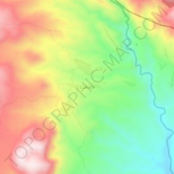
Name: Lukasi topographic map, elevation, terrain.

Location: Lukasi, Busokelo, Mbeya, Southern Highlands Zone, Tanzanie (-9.27372 33.84182 -9.23372 33.88182)

Average elevation: 3,556 ft

Minimum elevation: 2,694 ft

Maximum elevation: 4,534 ft

Other topographic maps

Click on a map to view its topography, its elevation and its terrain.

Rungwe

Tanzanie > Mbeya

Rungwe, Mbeya, Southern Highlands Zone, Tanzanie

Average elevation: 8,648 ft

Chunya

Tanzanie > Mbeya

Chunya, Mbeya, Southern Highlands Zone, Tanzanie

Average elevation: 4,098 ft

Rungwe

Tanzanie > Mbeya

Rungwe, Mbeya, Southern Highlands Zone, Tanzanie

Average elevation: 5,217 ft

Kieyo

Tanzanie > Mbeya

Kieyo, Rungwe, Mbeya, Southern Highlands Zone, Tanzanie

Average elevation: 6,476 ft