
Puy de Lassolas topographic map
Interactive map
Click on the map to display elevation.
About this map
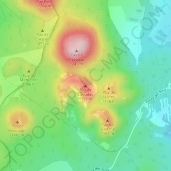
Name: Puy de Lassolas topographic map, elevation, terrain.
Average elevation: 3,386 ft
Minimum elevation: 3,009 ft
Maximum elevation: 4,029 ft
Other topographic maps
Click on a map to view its topography, its elevation and its terrain.
Nadaillat
France > Auvergne-Rhône-Alpes > Saint-Genès-Champanelle > Nadaillat
Nadaillat, Saint-Genès-Champanelle, Clermont-Ferrand, Puy-de-Dôme, Auvergne-Rhône-Alpes, France métropolitaine, 63122, France
Average elevation: 2,697 ft