
Góñar topographic map
Interactive map
Click on the map to display elevation.
About this map
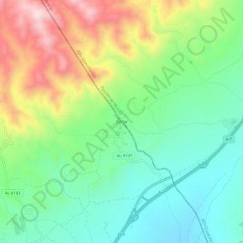
Name: Góñar topographic map, elevation, terrain.
Location: Góñar, Puerto Lumbreras, Alto Guadalentín, España (37.47448 -1.89423 37.51448 -1.85423)
Average elevation: 1,788 ft
Minimum elevation: 1,309 ft
Maximum elevation: 2,644 ft
Other topographic maps
Click on a map to view its topography, its elevation and its terrain.
Esparragal
España > Alto Guadalentín > Puerto Lumbreras
Esparragal, Puerto Lumbreras, Alto Guadalentín, 30817, España
Average elevation: 1,102 ft