
Ragland topographic map
Interactive map
Click on the map to display elevation.
About this map
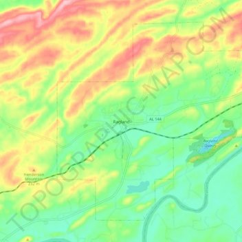
Name: Ragland topographic map, elevation, terrain.
Location: Ragland, St. Clair County, Alabama, États-Unis d'Amérique (33.70720 -86.18476 33.78008 -86.07791)
Average elevation: 617 ft
Minimum elevation: 394 ft
Maximum elevation: 938 ft
Other topographic maps
Click on a map to view its topography, its elevation and its terrain.
Riverside
États-Unis d'Amérique > Alabama > St. Clair County
Riverside, St. Clair County, Alabama, 35135, États-Unis d'Amérique
Average elevation: 522 ft