
La Tesserie topographic map
Interactive map
Click on the map to display elevation.
About this map
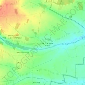
Name: La Tesserie topographic map, elevation, terrain.
Average elevation: 702 ft
Minimum elevation: 636 ft
Maximum elevation: 784 ft
Other topographic maps
Click on a map to view its topography, its elevation and its terrain.
La Touchardière
France > Centre-Val de Loire > Eure-et-Loir > Charbonnières
La Touchardière, Charbonnières, Nogent-le-Rotrou, Eure-et-Loir, Centre-Val de Loire, France métropolitaine, 28330, France
Average elevation: 735 ft
La Moinetière
France > Centre-Val de Loire > Eure-et-Loir > Charbonnières > La Moinetière
La Moinetière, Charbonnières, Nogent-le-Rotrou, Eure-et-Loir, Centre-Val de Loire, France métropolitaine, 28330, France
Average elevation: 725 ft