
Thank you for supporting this site ❤️
Make a donation
Make a donation
Gear up for your next adventure:
As an Amazon Associate, this site earns from qualifying purchases at no extra cost to you.
东寨村 topographic map
Click on the map to display elevation.
Thank you for supporting this site ❤️
Make a donation
Make a donation
Gear up for your next adventure:
As an Amazon Associate, this site earns from qualifying purchases at no extra cost to you.
About this map
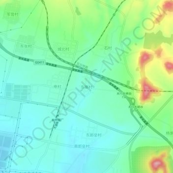
Name: 东寨村 topographic map, elevation, terrain.
Location: 东寨村, 林州市, 安阳市, 河南省, 中国 (36.13109 113.85069 36.17109 113.89069)
Average elevation: 1,053 ft
Minimum elevation: 906 ft
Maximum elevation: 1,444 ft
Thank you for supporting this site ❤️
Make a donation
Make a donation
Gear up for your next adventure:
As an Amazon Associate, this site earns from qualifying purchases at no extra cost to you.