
卡浪淌 topographic map
Interactive map
Click on the map to display elevation.
About this map
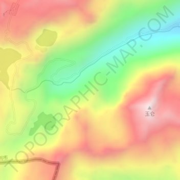
Name: 卡浪淌 topographic map, elevation, terrain.
Location: 卡浪淌, 下亚东乡, 亚东县, 日喀则市, 西藏自治区, 中国 (27.40570 88.81639 27.42570 88.83639)
Average elevation: 14,400 ft
Minimum elevation: 12,940 ft
Maximum elevation: 15,748 ft
Other topographic maps
Click on a map to view its topography, its elevation and its terrain.