
San Isidro de Patulu topographic map
Interactive map
Click on the map to display elevation.
About this map
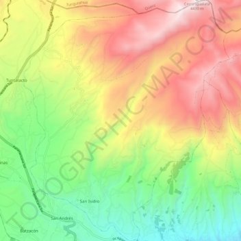
Name: San Isidro de Patulu topographic map, elevation, terrain.
Location: San Isidro de Patulu, Guano, Chimborazo, Ecuador (-1.60200 -78.71875 -1.49346 -78.62600)
Average elevation: 11,345 ft
Minimum elevation: 8,835 ft
Maximum elevation: 14,432 ft
Other topographic maps
Click on a map to view its topography, its elevation and its terrain.
San Gerardo de Pacaicaguan
Ecuador > Chimborazo > Guano
San Gerardo de Pacaicaguan, Guano, Chimborazo, Ecuador
Average elevation: 8,809 ft