
Varbergs kommun topographic map
Interactive map
Click on the map to display elevation.
About this map
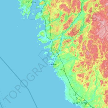
Name: Varbergs kommun topographic map, elevation, terrain.
Location: Varbergs kommun, Comté de Halland, Suède (56.96491 11.73185 57.35159 12.76368)
Average elevation: 115 ft
Minimum elevation: -3 ft
Maximum elevation: 686 ft
Other topographic maps
Click on a map to view its topography, its elevation and its terrain.