Geolocate

Calumet topographic map

Click on the map to display elevation.

About this map

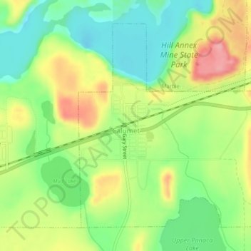
Name: Calumet topographic map, elevation, terrain.

Location: Calumet, Itasca County, Minnesota, 55716, United States (47.31142 -93.28441 47.33341 -93.24745)

Average elevation: 1,381 ft

Minimum elevation: 1,224 ft

Maximum elevation: 1,591 ft

Minnesota trails, hiking, mountain biking, running and outdoor activities

Gear up for your next adventure:

🔊Portable Camp Speaker - Music and alerts at camp
📖Nature Tracking Books - Learn to track wildlife and terrain
🪶Camp Gear Gift Set - Perfect gift bundle for outdoor fans
🥇GPS Hiking Watch - Multi‑sport GPS watch with navigation and trail tracking
🔪Outdoor Multitools - Essential survival tools for gear repair and field use

As an Amazon Associate, this site earns from qualifying purchases at no extra cost to you.