
Ouled Sidi M'Hamed topographic map
Interactive map
Click on the map to display elevation.
About this map
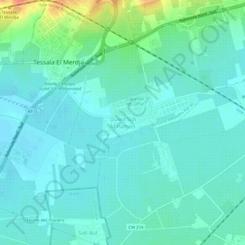
Name: Ouled Sidi M'Hamed topographic map, elevation, terrain.
Average elevation: 128 ft
Minimum elevation: 92 ft
Maximum elevation: 269 ft
Other topographic maps
Click on a map to view its topography, its elevation and its terrain.
Baba Ali
Algérie > Alger > Daïra Birtouta > Birtouta
Baba Ali, Birtouta, Daïra Birtouta, Alger, 16096, Algérie
Average elevation: 131 ft