Geolocate

Augusta topographic map

Click on the map to display elevation.

About this map

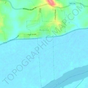
Name: Augusta topographic map, elevation, terrain.

Location: Augusta, Saint Charles County, Missouri, United States (38.55156 -90.89138 38.58328 -90.87141)

Average elevation: 505 ft

Minimum elevation: 463 ft

Maximum elevation: 758 ft

Saint Charles County trails, hiking, mountain biking, running and outdoor activities

Gear up for your next adventure:

📖Nature Tracking Books - Learn to track wildlife and terrain
🧷Carabiner Set - Durable clips for gear attachment
😴Insulated Sleeping Pads - Compact and warm pads for high-elevation camping
🪑Ultralight Camp Chairs - Portable seating for resting after a long day of mapping
🪶LED Camping Lantern - Bright lantern for camp lighting

As an Amazon Associate, this site earns from qualifying purchases at no extra cost to you.