
Tabaçó topographic map
Interactive map
Click on the map to display elevation.
About this map
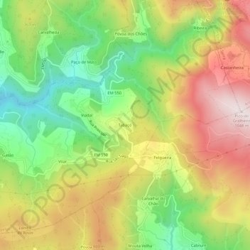
Name: Tabaçó topographic map, elevation, terrain.
Location: Tabaçó, Cepelos, Vale de Cambra, Aveiro, 4540-013, Portugal (40.82270 -8.32426 40.86270 -8.28426)
Average elevation: 2,349 ft
Minimum elevation: 1,371 ft
Maximum elevation: 3,435 ft
Other topographic maps
Click on a map to view its topography, its elevation and its terrain.
Merlães
Portugal > Aveiro > Vale de Cambra > Cepelos
Merlães, Cepelos, Vale de Cambra, Aveiro, 3730-289, Portugal
Average elevation: 1,841 ft