
Şehzadeler topographic map
Interactive map
Click on the map to display elevation.
About this map
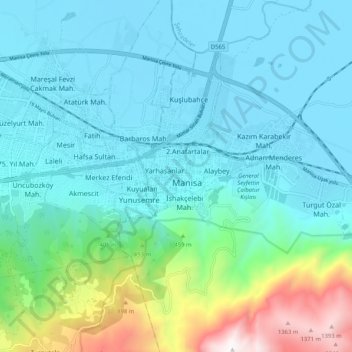
Name: Şehzadeler topographic map, elevation, terrain.
Location: Şehzadeler, Manisa, Aegean Region, 45020, Turkey (38.57402 27.39030 38.65402 27.47030)
Average elevation: 971 ft
Minimum elevation: 79 ft
Maximum elevation: 4,846 ft
Other topographic maps
Click on a map to view its topography, its elevation and its terrain.
Manisa
Manisa, Şehzadeler, Manisa, Aegean Region, 45020, Turkey
Average elevation: 830 ft