
Thank you for supporting this site ❤️
Make a donation
Make a donation
Gear up for your next adventure:
As an Amazon Associate, this site earns from qualifying purchases at no extra cost to you.
Mandritsara topographic map
Click on the map to display elevation.
Thank you for supporting this site ❤️
Make a donation
Make a donation
Gear up for your next adventure:
As an Amazon Associate, this site earns from qualifying purchases at no extra cost to you.
About this map
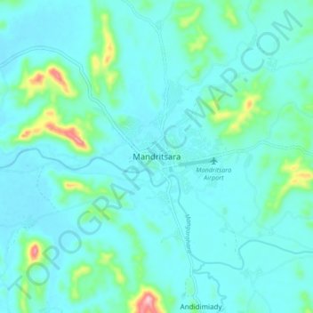
Name: Mandritsara topographic map, elevation, terrain.
Location: Mandritsara, Sofia Region, Province de Mahajanga, Madagascar (-15.88432 48.78389 -15.80432 48.86389)
Average elevation: 1,060 ft
Minimum elevation: 948 ft
Maximum elevation: 1,749 ft
Thank you for supporting this site ❤️
Make a donation
Make a donation
Gear up for your next adventure:
As an Amazon Associate, this site earns from qualifying purchases at no extra cost to you.