
Duna topographic map
Interactive map
Click on the map to display elevation.
About this map
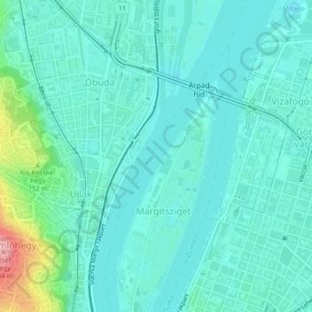
Name: Duna topographic map, elevation, terrain.
Location: Duna, Boedapest, Közép-Magyarország, 1036, Hongarije (47.53105 19.04551 47.53295 19.04701)
Average elevation: 374 ft
Minimum elevation: 295 ft
Maximum elevation: 738 ft
Other topographic maps
Click on a map to view its topography, its elevation and its terrain.
V. kerület
V. kerület, Boedapest, Centraal-Hongarije, Hongarije
Average elevation: 400 ft
VII. kerület
VII. kerület, Boedapest, Centraal-Hongarije, Hongarije
Average elevation: 377 ft
Lágymányos
Lágymányos, 11. kerület, Boedapest, Közép-Magyarország, Hongarije
Average elevation: 384 ft
Újlipótváros
Újlipótváros, 13. kerület, Boedapest, Közép-Magyarország, Hongarije
Average elevation: 361 ft