
Isola di Gavi topographic map
Interactive map
Click on the map to display elevation.
About this map
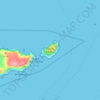
Name: Isola di Gavi topographic map, elevation, terrain.
Location: Isola di Gavi, Ponza, LT, LAZ, Italia (40.93274 12.99686 40.93749 13.00373)
Average elevation: 20 ft
Minimum elevation: 0 ft
Maximum elevation: 436 ft
Other topographic maps
Click on a map to view its topography, its elevation and its terrain.