Geolocate

Bo'ness topographic map

Click on the map to display elevation.

About this map

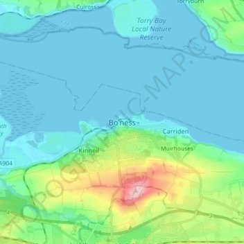
Name: Bo'ness topographic map, elevation, terrain.

Location: Bo'ness, Falkirk, Scotland, EH51 9AB, United Kingdom (55.97769 -3.64736 56.05769 -3.56736)

Average elevation: 95 ft

Minimum elevation: -3 ft

Maximum elevation: 558 ft

Gear up for your next adventure:

📌Outdoor GPS Map App - Apps and devices for digital topographic navigation
🌡️Portable Weather Meter - Track weather conditions on the trail
💧Water Filtration Bottles - Safely drink from streams and lakes while exploring
🦺Reflective Outdoor Gear - Safety gear for low‑light conditions
👓Polarized Sunglasses - Outdoor sunglasses for glare reduction

As an Amazon Associate, this site earns from qualifying purchases at no extra cost to you.