
Cazenovia topographic map
Interactive map
Click on the map to display elevation.
About this map
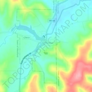
Name: Cazenovia topographic map, elevation, terrain.
Location: Cazenovia, Richland County, Wisconsin, USA (43.51115 -90.20889 43.53289 -90.19063)
Average elevation: 1,027 ft
Minimum elevation: 906 ft
Maximum elevation: 1,276 ft