
Currie topographic map
Interactive map
Click on the map to display elevation.
About this map
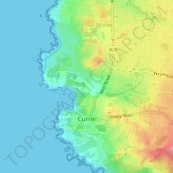
Name: Currie topographic map, elevation, terrain.
Location: Currie, King Island Council, Tasmania, 7265, Australia (-39.94628 143.83268 -39.89866 143.87104)
Average elevation: 82 ft
Minimum elevation: -10 ft
Maximum elevation: 272 ft
Other topographic maps
Click on a map to view its topography, its elevation and its terrain.
Bicentennial Park
Bicentennial Park, Currie, King Island Council, Tasmania, 7265, Australia
Average elevation: 66 ft