
Honeymoon Island topographic map
Interactive map
Click on the map to display elevation.
About this map
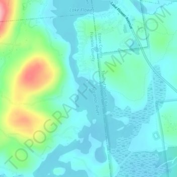
Name: Honeymoon Island topographic map, elevation, terrain.
Average elevation: 1,604 ft
Minimum elevation: 1,512 ft
Maximum elevation: 1,959 ft
Other topographic maps
Click on a map to view its topography, its elevation and its terrain.
Yaphank
United States of America > New York > Yaphank
Yaphank, Suffolk, New York, 11980, United States of America
Average elevation: 79 ft
Saratoga County
United States of America > New York
Saratoga County, New York, United States of America
Average elevation: 715 ft
Westchester
United States of America > New York
Westchester, New York, United States of America
Average elevation: 312 ft
Essex County
United States of America > New York
Essex County, New York, United States of America
Average elevation: 1,371 ft
Farmingville
United States of America > New York > Farmingville
Farmingville, Suffolk, New York, 11738, United States of America
Average elevation: 154 ft
Riverhead
United States of America > New York > Riverhead
Riverhead, Suffolk County, New York, United States of America
Average elevation: 43 ft
Syracuse
United States of America > New York > Syracuse
Syracuse, Onondaga County, New York, United States of America
Average elevation: 564 ft
Barrytown
United States of America > New York > Barrytown
Barrytown, Town of Red Hook, Dutchess, New York, 12507, United States of America
Average elevation: 112 ft
Sullivan County
United States of America > New York
Sullivan County, New York, United States of America
Average elevation: 1,427 ft
Chenango County
United States of America > New York
Chenango County, New York, United States of America
Average elevation: 1,450 ft
Niagara County
United States of America > New York
Niagara County, New York, United States of America
Average elevation: 449 ft
Saint Lawrence County
United States of America > New York
Saint Lawrence County, New York, United States of America
Average elevation: 784 ft
Nassau County
United States of America > New York
Nassau County, New York, United States of America
Average elevation: 59 ft
Niagara Falls
United States of America > New York > Niagara Falls
Niagara Falls, Niagara County, New York, United States of America
Average elevation: 591 ft