
Somrane topographic map
Interactive map
Click on the map to display elevation.
About this map
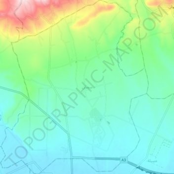
Name: Somrane topographic map, elevation, terrain.
Location: Somrane, Balta Bouawene, Jendouba, Tunisie (36.63072 8.91905 36.69701 8.98943)
Average elevation: 656 ft
Minimum elevation: 423 ft
Maximum elevation: 1,394 ft
Other topographic maps
Click on a map to view its topography, its elevation and its terrain.