
Wijnegem topographic map
Interactive map
Click on the map to display elevation.
About this map
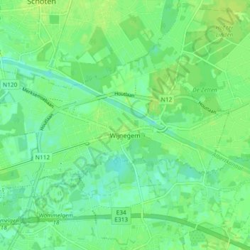
Name: Wijnegem topographic map, elevation, terrain.
Location: Wijnegem, Antwerp, Flanders, 2110, Belgium (51.21563 4.47994 51.24216 4.55309)
Average elevation: 26 ft
Minimum elevation: 3 ft
Maximum elevation: 39 ft