
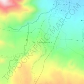
San Buenaventura topographic map
Interactive map
Click on the map to display elevation.
About this map
Name: San Buenaventura topographic map, elevation, terrain.
Location: San Buenaventura, San Francisco de Yojoa, Cortés, Honduras (15.00506 -88.01523 15.04506 -87.97523)
Average elevation: 974 ft
Minimum elevation: 249 ft
Maximum elevation: 2,228 ft