Geolocate

Kulgam topographic map

Click on the map to display elevation.

About this map

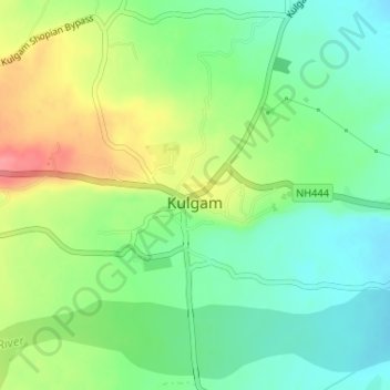
Name: Kulgam topographic map, elevation, terrain.

Location: Kulgam, Jammu and Kashmir, India (33.64190 75.01052 33.64854 75.02994)

Average elevation: 5,682 ft

Minimum elevation: 5,577 ft

Maximum elevation: 5,850 ft

Gear up for your next adventure:

🔦LED Headlamp - Bright and durable LED headlamp for night navigation
Backpacking Tent - Lightweight and durable tent for multi‑day hikes
🛶Inflatable Kayak - Portable kayak for rivers, lakes, and expeditions
🪶Trail Camera - Capture wildlife on your hikes
🧦Merino Wool Socks - Moisture-wicking, blister-preventing socks for long treks

As an Amazon Associate, this site earns from qualifying purchases at no extra cost to you.