
Tabangao Hilltop topographic map
Interactive map
Click on the map to display elevation.
About this map
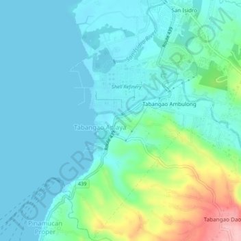
Name: Tabangao Hilltop topographic map, elevation, terrain.
Average elevation: 108 ft
Minimum elevation: 0 ft
Maximum elevation: 528 ft
Other topographic maps
Click on a map to view its topography, its elevation and its terrain.
Ambulong River
Philippines > Batangas > Batangas City > Tabangao Aplaya
Ambulong River, Tabangao Aplaya, Batangas City, Batangas, Calabarzon, 4200, Philippines
Average elevation: 69 ft