
Zacatelco topographic map
Interactive map
Click on the map to display elevation.
About this map
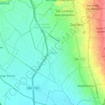
Name: Zacatelco topographic map, elevation, terrain.
Location: Zacatelco, Tlaxcala, México (19.16075 -98.30631 19.23271 -98.23024)
Average elevation: 7,211 ft
Minimum elevation: 7,142 ft
Maximum elevation: 7,392 ft
Other topographic maps
Click on a map to view its topography, its elevation and its terrain.