
Lac des Truites topographic map
Interactive map
Click on the map to display elevation.
About this map
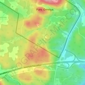
Name: Lac des Truites topographic map, elevation, terrain.
Average elevation: 568 ft
Minimum elevation: 354 ft
Maximum elevation: 823 ft
Other topographic maps
Click on a map to view its topography, its elevation and its terrain.
Notre-Dame-de-Bonsecours
Canada > Québec > Papineau > Notre-Dame-de-Bonsecours
Notre-Dame-de-Bonsecours, Papineau, Outaouais, Québec, J0V 1L0, Canada
Average elevation: 676 ft