
Oredo topographic map
Interactive map
Click on the map to display elevation.
About this map
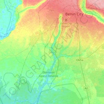
Name: Oredo topographic map, elevation, terrain.
Location: Oredo, Edo State, Nigeria (6.09115 5.46225 6.37050 5.64913)
Average elevation: 125 ft
Minimum elevation: 7 ft
Maximum elevation: 344 ft
Other topographic maps
Click on a map to view its topography, its elevation and its terrain.
Okada
Nigeria > Edo State > Ovia North-East
Okada, Ovia North-East, Edo State, Nigeria
Average elevation: 210 ft
Benin City
Benin City, Oredo, Edo State, 300241, Nigeria
Average elevation: 236 ft