
KG Hadersdorf topographic map
Interactive map
Click on the map to display elevation.
About this map
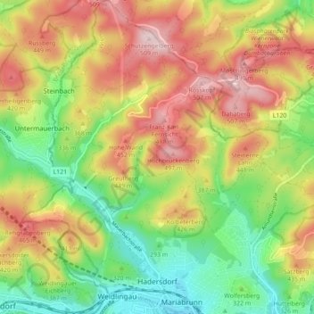
Name: KG Hadersdorf topographic map, elevation, terrain.
Location: KG Hadersdorf, Penzing, Wien, 1140, Österreich (48.20623 16.18517 48.26421 16.26922)
Average elevation: 1,175 ft
Minimum elevation: 715 ft
Maximum elevation: 1,693 ft