
Sangar topographic map
Interactive map
Click on the map to display elevation.
About this map
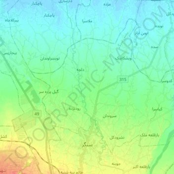
Name: Sangar topographic map, elevation, terrain.
Location: Sangar, بخش سنگر, Rasht County, Gilan Province, Iran (37.17168 49.64208 37.26331 49.78758)
Average elevation: 52 ft
Minimum elevation: -7 ft
Maximum elevation: 197 ft