
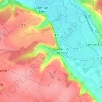
Saint-Aquilin-de-Pacy topographic map
Interactive map
Click on the map to display elevation.
About this map
Name: Saint-Aquilin-de-Pacy topographic map, elevation, terrain.
Average elevation: 289 ft
Minimum elevation: 118 ft
Maximum elevation: 449 ft
Other topographic maps
Click on a map to view its topography, its elevation and its terrain.
27120
France > Normandie > Eure > Pacy-sur-Eure
27120, Pacy-sur-Eure, Les Andelys, Eure, Normandie, France métropolitaine, France
Average elevation: 200 ft
Pacy-sur-Eure
France > Normandie > Eure > Pacy-sur-Eure
Pacy-sur-Eure, Les Andelys, Eure, Normandie, France métropolitaine, 27120, France
Average elevation: 325 ft