
Lac de Serre-Ponçon topographic map
Interactive map
Click on the map to display elevation.
About this map
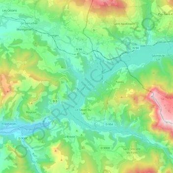
Name: Lac de Serre-Ponçon topographic map, elevation, terrain.
Average elevation: 3,570 ft
Minimum elevation: 2,096 ft
Maximum elevation: 7,746 ft
La crête du barrage est à l'altitude de 783,5 mètres.