
Järbo topographic map
Interactive map
Click on the map to display elevation.
About this map
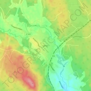
Name: Järbo topographic map, elevation, terrain.
Location: Järbo, Sandvikens kommun, Gävleborg County, 811 71, Sweden (60.69993 16.57722 60.73993 16.61722)
Average elevation: 397 ft
Minimum elevation: 259 ft
Maximum elevation: 571 ft
Other topographic maps
Click on a map to view its topography, its elevation and its terrain.
Ljusdals kommun
Ljusdals kommun, Gävleborg County, Sweden
Average elevation: 1,033 ft