
Anseremme topographic map
Interactive map
Click on the map to display elevation.
About this map
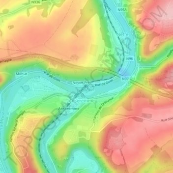
Name: Anseremme topographic map, elevation, terrain.
Location: Anseremme, Dinant, Namur, Wallonie, 5500, Belgique (50.24005 4.90911 50.24016 4.91060)
Average elevation: 528 ft
Minimum elevation: 246 ft
Maximum elevation: 801 ft
Other topographic maps
Click on a map to view its topography, its elevation and its terrain.
Fonds de Leffe
Fonds de Leffe, Dinant, Namur, Wallonie, 5501, Belgique
Average elevation: 696 ft