Geolocate

Dearborn topographic map

Click on the map to display elevation.

About this map

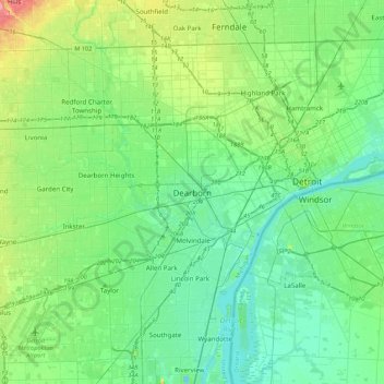
Name: Dearborn topographic map, elevation, terrain.

Location: Dearborn, Wayne County, Michigan, 48126, United States (42.16226 -83.33631 42.48226 -83.01631)

Average elevation: 623 ft

Minimum elevation: 554 ft

Maximum elevation: 850 ft

Wayne County trails, hiking, mountain biking, running and outdoor activities

Other topographic maps

Click on a map to view its topography, its elevation and its terrain.

Gear up for your next adventure:

💧Water Purification System - Clean water on the trail with reliable purifiers
🦟Ultrasonic Repellers - Create a bug-free zone at your camp or rest stop
🗻Climbing Gear Basics - Essential gear for beginner climbers
🎒Day Hiking Backpack - Lightweight backpack perfect for day trips and outdoor adventures
🔭Telescopic Hiking Pole - Adjustable pole for hiking stability

As an Amazon Associate, this site earns from qualifying purchases at no extra cost to you.