
Thank you for supporting this site ❤️
Make a donation
Make a donation
Gear up for your next adventure:
As an Amazon Associate, this site earns from qualifying purchases at no extra cost to you.
Amalou topographic map
Click on the map to display elevation.
Thank you for supporting this site ❤️
Make a donation
Make a donation
Gear up for your next adventure:
As an Amazon Associate, this site earns from qualifying purchases at no extra cost to you.
About this map
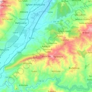
Name: Amalou topographic map, elevation, terrain.
Location: Amalou, Seddouk District, Bejaia, 06034, Algeria (36.44130 4.55234 36.51472 4.72221)
Average elevation: 1,342 ft
Minimum elevation: 361 ft
Maximum elevation: 3,701 ft
Thank you for supporting this site ❤️
Make a donation
Make a donation
Gear up for your next adventure:
As an Amazon Associate, this site earns from qualifying purchases at no extra cost to you.