Geolocate

Cochabamba topographic map

Click on the map to display elevation.

About this map

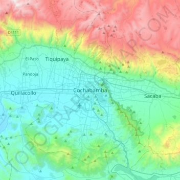
Name: Cochabamba topographic map, elevation, terrain.

Location: Cochabamba, Cercado, Cochabamba, Bolivia (-17.55361 -66.31690 -17.23361 -65.99690)

Average elevation: 10,318 ft

Minimum elevation: 8,225 ft

Maximum elevation: 15,830 ft

Other topographic maps

Click on a map to view its topography, its elevation and its terrain.

Distrito 1

Bolivia > Cochabamba > Cercado > Cochabamba

Average elevation: 8,898 ft

Gear up for your next adventure:

🧤Tactile Hiking Gloves - Keep hands warm while operating GPS and smartphone screens
🔪Outdoor Multitools - Essential survival tools for gear repair and field use
📷Action Cameras - Rugged cameras to document your journeys across rugged terrain
🧥Men's Rain Shells - Premium waterproof and breathable jackets for mountain weather
🔭Telescopic Hiking Pole - Adjustable pole for hiking stability

As an Amazon Associate, this site earns from qualifying purchases at no extra cost to you.