
Thank you for supporting this site ❤️
Make a donation
Make a donation
Gear up for your next adventure:
As an Amazon Associate, this site earns from qualifying purchases at no extra cost to you.
Beltran topographic map
Click on the map to display elevation.
Thank you for supporting this site ❤️
Make a donation
Make a donation
Gear up for your next adventure:
As an Amazon Associate, this site earns from qualifying purchases at no extra cost to you.
About this map
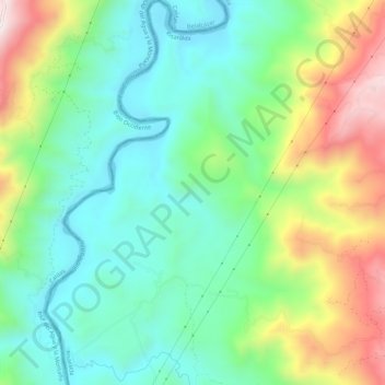
Name: Beltran topographic map, elevation, terrain.
Location: Beltran, Marsella, Risaralda, RAP Eje Cafetero, Colombia (4.95571 -75.79598 5.01127 -75.76016)
Average elevation: 3,537 ft
Minimum elevation: 2,733 ft
Maximum elevation: 5,154 ft
Thank you for supporting this site ❤️
Make a donation
Make a donation
Gear up for your next adventure:
As an Amazon Associate, this site earns from qualifying purchases at no extra cost to you.