
Case Barberis topographic map
Interactive map
Click on the map to display elevation.
About this map
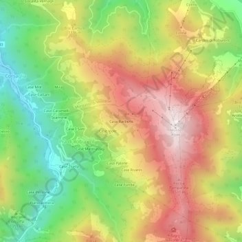
Name: Case Barberis topographic map, elevation, terrain.
Location: Case Barberis, Prà di Roburent, Roburent, Coni, Piémont, Italie (44.24197 7.84511 44.28197 7.88511)
Average elevation: 3,720 ft
Minimum elevation: 2,244 ft
Maximum elevation: 5,262 ft