Geolocate

Saundersfoot topographic map

Click on the map to display elevation.

About this map
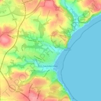
Name: Saundersfoot topographic map, elevation, terrain.

Location: Saundersfoot, Pembrokeshire, Wales, United Kingdom (51.69883 -4.72812 51.73372 -4.68324)

Average elevation: 135 ft

Minimum elevation: 0 ft

Maximum elevation: 331 ft

Gear up for your next adventure:

🩳Quick‑Dry Hiking Shorts - Comfortable and quick‑dry shorts for summer hiking
🗺️NatGeo Topo Maps - High-quality waterproof printed topographic maps of US Parks
🧺Microfiber Travel Towels - Compact and fast-drying towels for trail use
🦟Ultrasonic Repellers - Create a bug-free zone at your camp or rest stop
💧Water Filtration Bottles - Safely drink from streams and lakes while exploring

As an Amazon Associate, this site earns from qualifying purchases at no extra cost to you.