
Manabao topographic map
Interactive map
Click on the map to display elevation.
About this map
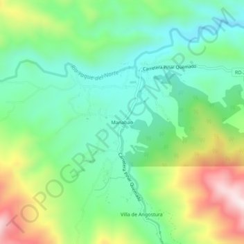
Name: Manabao topographic map, elevation, terrain.
Location: Manabao, Jarabacoa, La Vega, República Dominicana (19.04549 -70.81341 19.08549 -70.77341)
Average elevation: 3,284 ft
Minimum elevation: 2,671 ft
Maximum elevation: 4,518 ft